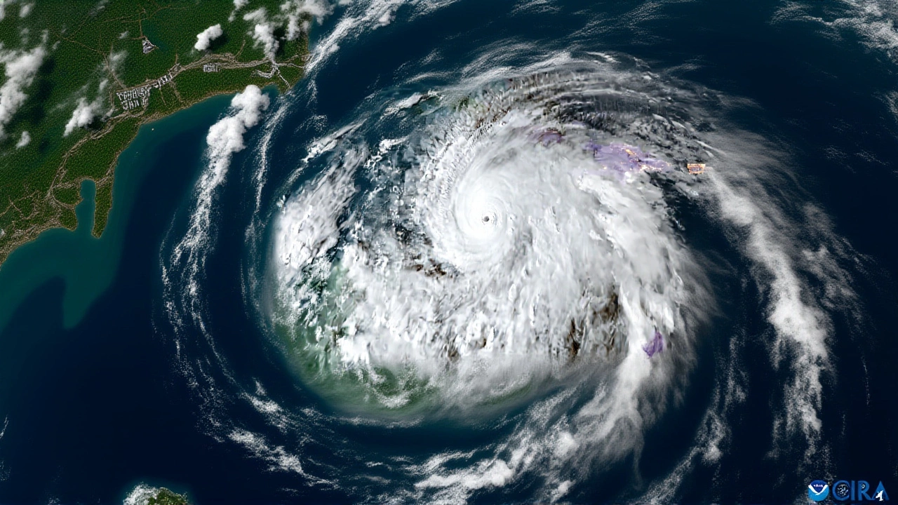
When National Oceanic and Atmospheric Administration (NOAA) dropped its 2026 Atlantic hurricane outlook on Thursday, May 21, 2026, the message was clear: breathe a little easier, but don’t pack away your sandbags just yet. Forecasters predict a below-normal season, driven largely by the return of El Niño conditions in the Pacific Ocean. It’s a welcome shift after recent years of hyperactive seasons, but the stakes remain high for coastal communities.
The official forecast calls for 8 to 14 named storms across the Atlantic basin. Of those, 3 to 6 are expected to strengthen into hurricanes with winds of at least 74 mph, and 1 to 3 could become major hurricanes (Category 3 or higher). For context, an average season sees 14 named storms, 7 hurricanes, and 3 major ones. So, while we’re looking at fewer systems overall, the potential for intense damage from any single storm remains very real.
The El Niño Effect
Here’s the thing: weather patterns are interconnected. The primary driver behind this quieter prediction is the anticipated development of El Niño. NOAA assigns a 98% probability that El Niño conditions will emerge later in the season, with an 80% chance it will be moderate to strong.
El Niño acts like a brake on Atlantic hurricane activity. It increases vertical wind shear—the difference in wind speed and direction between the upper and lower atmosphere—which tears apart developing storms before they can organize. James Franklin, lead forecaster at the National Hurricane Center in Miami, Florida, explained it simply: "El Niño's the main factor and that's saying, 'Hey, we're going to be less active,' but there are a lot of smaller factors out there that are saying it could be more active than usual, but El Niño's going to take precedent."
This isn't the first time El Niño has suppressed Atlantic activity. In 2015 and 2019, similar conditions led to below-average seasons. However, climate change adds a layer of complexity. Warmer ocean temperatures mean that when storms do form, they have more energy available, potentially leading to rapid intensification.
Independent Forecasts Align
You’re not just hearing this from one source. Colorado State University's Tropical Meteorology Project, led by Dr. Philip Klotzbach in Fort Collins, Colorado, released a complementary forecast. They anticipate somewhat below-normal activity, predicting 13 named storms, 6 hurricanes, and 2 major hurricanes. CSU’s model notes that while sea surface temperatures in the western tropical Atlantic are warmer than normal, the eastern and central Atlantic are slightly cooler—a pattern consistent with El Niño’s influence.
The Canadian Hurricane Centre in Dartmouth, Nova Scotia, also issued a below-average prediction, aligning with both NOAA and CSU. This consensus among major meteorological agencies adds weight to the forecast, though experts caution that long-range predictions always carry uncertainty.
Risk Remains High for Landfalls
But wait—does a "below-normal" season mean you’re safe? Not necessarily. NOAA estimates a 32% chance that a major hurricane will make landfall somewhere along the U.S. coastline during the 2026 season. That’s actually higher than the historical average of about 25%. Florida, as usual, sits at the top of the risk list for landfall probability.
Why the discrepancy? Because even in a quiet season, one powerful storm can cause billions in damage. Think back to 2017. It wasn’t the most active season by count, but Harvey, Irma, and Maria combined to create some of the costliest disasters in U.S. history. The lesson? Preparedness matters more than the total number of storms.
Matthew Rosencrans, director of NOAA’s Climate Prediction Center, emphasized this point: "These percentages are based on multiple factors that represent a probabilistic distribution which includes a lot of information," he said, acknowledging "high levels of uncertainty" in long-range forecasting. He added, "Even if we're saying it could be a slightly less active season, always caution to prepare for the worst."

Pacific Basin Sees Opposite Trend
While the Atlantic may see a reprieve, the Pacific is bracing for a busy year. NOAA predicted above-normal activity in the central and eastern Pacific, with a 70% chance of exceeding averages. Forecasters expect 15 to 22 named storms in the eastern Pacific alone, including 9 to 14 hurricanes and 5 to 9 major hurricanes. This inverse relationship is typical: when the Atlantic is suppressed by El Niño, the Pacific often heats up.
Timeline and Peak Season
The 2026 Atlantic hurricane season officially runs from June 1 to November 30, 2026. Historically, the peak activity occurs during August, September, and October. This is when ocean temperatures consistently exceed 79°F, providing the thermal energy needed for storm strengthening. If El Niño develops as expected, the suppression effect will likely be most pronounced during these critical months.
However, early-season storms aren’t impossible. Recent trends show storms forming earlier in the year, sometimes in May or June. While the bulk of activity is expected later, residents should begin preparing now. Check insurance policies, clear gutters, and review emergency plans.
Frequently Asked Questions
What does "below-normal" hurricane activity mean?
A below-normal season means fewer named storms, hurricanes, and major hurricanes than the historical average. For 2026, NOAA predicts 8-14 named storms compared to the average of 14. However, "below-normal" doesn't mean no storms, and individual storms can still be devastating.
How does El Niño affect hurricanes?
El Niño increases vertical wind shear in the Atlantic, which disrupts storm formation and organization. It essentially tears apart developing systems before they can strengthen. This typically leads to fewer hurricanes in the Atlantic but more activity in the Pacific.
Is Florida still at high risk for a major hurricane?
Yes. Despite the overall below-normal forecast, NOAA cites a 32% chance of a major hurricane landfall on the U.S. coast, with Florida having the highest probability. One major storm can cause catastrophic damage regardless of the total seasonal count.
When is the peak of the 2026 hurricane season?
The peak activity historically occurs in August, September, and October. This is when ocean temperatures are warmest, exceeding the 79°F threshold needed for storm intensification. The season officially runs from June 1 to November 30.
Why is the Pacific hurricane season predicted to be above-normal?
El Niño warms waters in the central and eastern Pacific, creating favorable conditions for storm formation there. While it suppresses Atlantic activity via wind shear, it fuels Pacific cyclones. NOAA predicts a 70% chance of above-normal activity in the Pacific basin.